
the canadian shield, yesterday
 17 September 2011, 12:30 EDTWhere the flat, polished Canadian Shield slides into Georgian Bay, and
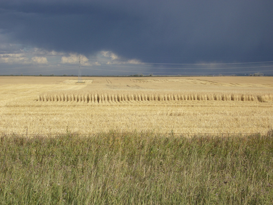 17 September 2011, 5pm MDTan oncoming storm, east of Calgary, looking over what was Lake Agassiz 10,000 years ago, ice age meltwater caught between the Rockies and the Canadian Shield.
addendum: well, that isn't quite right. Evidently we are looking at the Bassano Basin, formed by the same melting of the Wisconsinan Laurentide ice sheet. Calgary is 1048m elevation, Winnipeg in the Agassiz Basin is 238m, Regina, halfway between them is 577m. The land sank with the melting of the glacier, and Bassano drains south into the Missouri system, rather than north as does the Agassiz system. So somewhere on the great flat prairies that seems like a table top if you are driving across it, there is a series of different divides, different ancient watersheds.